

Meet the storm chaser who captured South Dakota’s first February tornado
Alex Resel not only saw history being made Monday, but the Watertown man also recorded it.
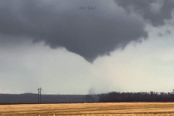
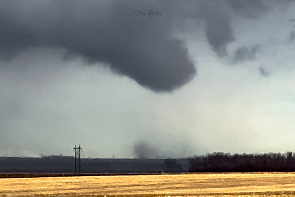
Resel, a storm chaser since 2022, shot video and still photos of the first February tornado ever reported in South Dakota.
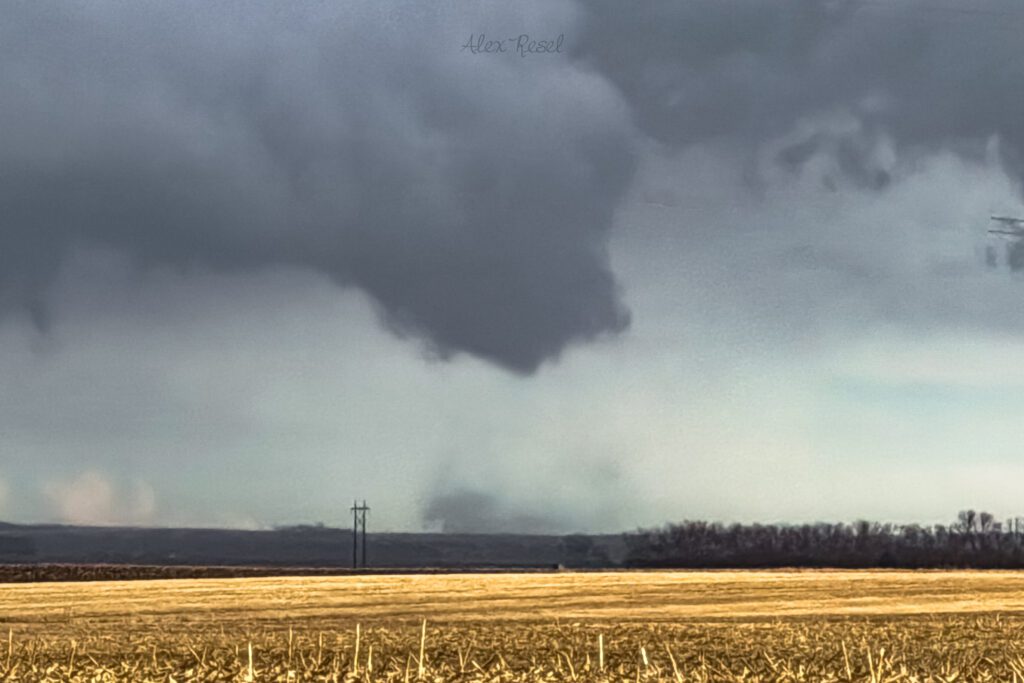
It touched down about 5 miles east of Castlewood and stayed on the ground for two to three minutes, doing no damage.
“I could see the funnel, I could see what my eyes were seeing, but my eyes couldn’t process it until a minute or two after it happened,” Resel said. “Then a storm-chasing friend of mine reached out to say there had never been a tornado ever documented in South Dakota in February.”
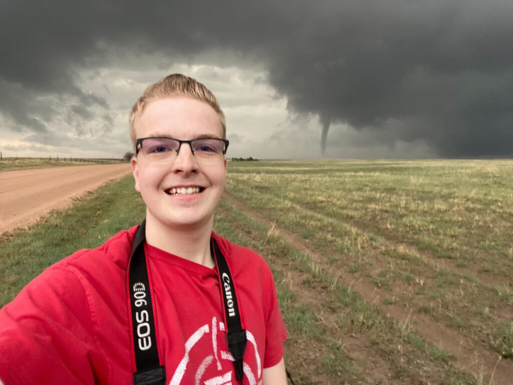
Alex Resel takes a photo of himself with a tornado in the background on May 10, 2023, west of Akron, Colorado.
According to information from The Weather Channel, based on reliable records from the National Oceanic and Atmospheric Administration dating to 1950, the state has never seen a tornado in a month better known for snow and blizzards.
In the last three-quarters of a century, while 1,918 tornadoes have been recorded in South Dakota, not one occurred in November, December, January or February. The National Weather Service rated Monday’s tornado as EFU. NWS uses that rating when evidence shows that a tornado has occurred without any damage.
Resel, 24, has seen the damage that tornadoes can do. Monday’s tornado was the 70th he had witnessed.
Last year, he was chasing a storm in Nebraska and Iowa in late April when a mile-wide EF3 tornado hit Minden, Iowa. The town’s eastern side was destroyed, leaving wrecked buildings, vehicles and lives in its path.
“I pulled into a driveway, and it was a one-level house, and the roof was completely gone, and half the building is not there,” Resel said. “A car was thrown from the driveway 200 yards to a field behind the house. It kind of humbled me. Just knowing what storms can do, it wakes you up.”
A lifelong Watertown resident, Resel graduated from Lake Area Technical Institute with a business degree in photography and digital media. He works at a manufacturing plant in Watertown while pursuing a part-time career in storm chasing. He hopes it will become a full-time occupation soon.
Resel’s fascination with storms began about a dozen years ago. He was 12 when tornado sirens sounded in Watertown, indicating a cyclone was approaching.
“The lightning and thunder and all that combined into this passion for weather,” he said.
Seeing storms cross the plains has given him a unique perspective, Resel said. He wants to experience it as often as he can, and he spends his free time examining weather models and planning his trips to likely sites.
“It’s definitely humbling,” he said. “When I’m out there, I’m taking a lot of risks. It kind of humbles you a bit to know what those storms can do. Their effects on people too. It brings out a sense of humbleness, just to see something so powerful and so big. It’s just a feeling I can’t really describe.”
On Monday morning, Resel didn’t expect that at 4 p.m. he would be chasing a tornado. The expectation was for a low-end general thunderstorm. He could tell by looking at the cloud-laden sky, however, that the potential was there, and he saw possible photographs in the lightning strikes.

At almost exactly 4 p.m., Resel knew he might see a tornado.
“There were a lot of rising clouds, and a rising motion is a key that things are trying to develop,” he said. “I saw a lot of subtle rotation at the base, then a wall cloud, which is kind of the final sign that the storm is trying to produce a tornado.”
That consolidated into what storm chasers call a bowl, and the cone funnel formed from that. In about 30 seconds, Resel could see where ground dirt and dust were kicking up, and that was his confirmation that the tornado was on the ground.
“It stayed in a field,” he said. “It was weak, thankfully.”
According to The Weather Channel and information from Steven Fleegel, a science and operations officer at the NWS in Aberdeen, “We did have a lot of shear near and just above the ground. The combination of that, with the front moving through, increased the surface circulation in that area. So those were able to combine with the little bit of instability we had to produce a rotating storm and the tornado.”
According to The Weather Channel, “most severe thunderstorms that spawn tornadoes need a combination of changing winds with height known as wind shear, as well as a significant difference in temperature and humidity with height, called instability. That temperature difference is usually warm, humid air near the ground topped by cold, dry air aloft.”
However, Monday wasn’t that humid. The temperature in Watertown hit 50 degrees, but the atmospheric spin made up for the humidity.
Resel is eager for the tornado season to officially begin. Storms are never the same, he said, and he’s looking forward to the variety.
It’s a misconception, however, that storm chasers are unaffected by the destruction they witness.
“We’re not out to see destruction but to admire Mother Nature for what it is,” Resel said. “If anybody tries to storm chase, please know that it’s a dangerous hobby and activity, and be smart about it. Don’t put yourself in danger for a photo or video. It’s kind of hard to explain, but the last thing we ever want to see is destruction and people’s lives being impacted forever.”
Share This Story
Most Recent
Videos


Looking amazing @dtsiouxfalls and @washpav! Thanks to @jpickthorn for capturing an incredible night.
Nov 26

Enjoy this glow headed into Halloween week! 📸: @jpickthorn
Oct 31
Hope you had a wonderful summer weekend and are recharged for the week ahead! 📸: @jpickthorn
Jun 27
Beautiful way to start a week! 📸: @jpickthorn
Jan 10
Favorite flyover of the year! Merry Christmas from our entire @pigeon605news flock. 🎄🐦 📸: @actsofnaturephotography
Dec 24
They definitely deserve to be treated like holiday royalty and they were! ❤️ these scenes from tonight’s lighting celebration at @sanfordhealth Children’s Hospital. 🎄
Dec 1
The holidays are here! Perfect night @dtsiouxfalls
Nov 27
Happy Halloween from @avera_health NICU babies! Link in bio to see more! 🎃
Oct 31
Did you know @dtsiouxfalls is filled with 👻 stories? Link in bio … if you dare 😱
Oct 8
When it comes to kids parties nobody wants to be cookie-cutter. Link in bio for the story on what’s trending.
Sep 28
Want to stay connected to where you live with more stories like this?
Adopt a free virtual “pigeon” to deliver news that will matter to you.
Read More

Are you a little bird with something to share?

Delivering news that matters to you
Years ago, homing pigeons were used to bring us news we needed. Today, your virtual “pigeon” will deliver what you want to know about the place you call home.
All pigeons are free to good homes!
Our Partners


